


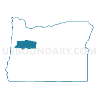
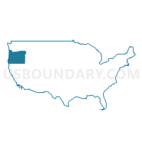
Linn & Benton Counties PUMA, Oregon
About
Outline

Summary
| Unique Area Identifier | 193817 |
| Name | Linn & Benton Counties PUMA |
| State | Oregon |
| Area (square miles) | 2,987.57 |
| Land Area (square miles) | 2,966.07 |
| Water Area (square miles) | 21.50 |
| % of Land Area | 99.28 |
| % of Water Area | 0.72 |
| Latitude of the Internal Point | 44.49290130 |
| Longtitude of the Internal Point | -122.74582180 |
Maps
Graphs
Select a template below for downloading or customizing gragh for Linn & Benton Counties PUMA, Oregon


Neighbors
Neighoring Public Use Microdata Area (by Name) Neighboring Public Use Microdata Area on the Map
- Columbia, Lincoln, Clatsop & Tillamook Counties PUMA, OR
- Deschutes County PUMA, OR
- Lane County (Outside Eugene & Springfield Cities) PUMA, OR
- Marion County (Outside Salem & Keizer Cities)--Woodburn & Silverton Cities PUMA, OR
- North Central Oregon--The Dalles City PUMA, OR
- Yamhill & Polk Counties PUMA, OR
Top 10 Neighboring County (by Population) Neighboring County on the Map
- Lane County, OR (351,715)
- Marion County, OR (315,335)
- Deschutes County, OR (157,733)
- Linn County, OR (116,672)
- Benton County, OR (85,579)
- Polk County, OR (75,403)
- Lincoln County, OR (46,034)
- Jefferson County, OR (21,720)
Top 10 Neighboring County Subdivision (by Population) Neighboring County Subdivision on the Map
- Corvallis CCD, Benton County, OR (65,959)
- Albany CCD, Linn County, OR (52,612)
- Sisters-Millican CCD, Deschutes County, OR (27,974)
- Lebanon CCD, Linn County, OR (25,155)
- Monmouth-Independence CCD, Polk County, OR (20,544)
- Stayton CCD, Marion County, OR (14,297)
- Sweet Home CCD, Linn County, OR (13,119)
- Jefferson CCD, Marion County, OR (12,032)
- Junction City CCD, Lane County, OR (11,809)
- North Albany CCD, Benton County, OR (8,519)
Top 10 Neighboring Place (by Population) Neighboring Place on the Map
- Corvallis city, OR (54,462)
- Albany city, OR (50,158)
- Lebanon city, OR (15,518)
- Sweet Home city, OR (8,925)
- Philomath city, OR (4,584)
- Harrisburg city, OR (3,567)
- Jefferson city, OR (3,098)
- Mill City city, OR (1,855)
- Brownsville city, OR (1,668)
- Millersburg city, OR (1,329)
Top 10 Neighboring Unified School District (by Population) Neighboring Unified School District on the Map
- Eugene School District 4J, OR (150,188)
- Corvallis School District 509J, OR (65,449)
- Greater Albany School District 8J, OR (60,802)
- Lincoln County School District, OR (46,192)
- Lebanon Community School District 9, OR (28,794)
- Central School District 13J, OR (21,561)
- Dallas School District 2, OR (20,376)
- Jefferson County School District 509J, OR (16,028)
- North Santiam School District 29J, OR (15,824)
- Sweet Home School District 55, OR (14,649)
Top 10 Neighboring State Legislative District Lower Chamber (by Population) Neighboring State Legislative District Lower Chamber on the Map
- State House District 53, OR (73,781)
- State House District 15, OR (67,333)
- State House District 14, OR (64,049)
- State House District 16, OR (62,759)
- State House District 23, OR (62,427)
- State House District 17, OR (61,383)
- State House District 11, OR (60,899)
- State House District 59, OR (60,455)
- State House District 7, OR (59,574)
- State House District 10, OR (58,977)
Top 10 Neighboring State Legislative District Upper Chamber (by Population) Neighboring State Legislative District Upper Chamber on the Map
- State Senate District 27, OR (155,590)
- State Senate District 8, OR (130,092)
- State Senate District 12, OR (128,429)
- State Senate District 7, OR (126,608)
- State Senate District 9, OR (123,674)
- State Senate District 6, OR (122,979)
- State Senate District 4, OR (122,124)
- State Senate District 5, OR (117,755)
- State Senate District 30, OR (115,913)
Top 10 Neighboring 111th Congressional District (by Population) Neighboring 111th Congressional District on the Map
- Congressional District 2, OR (769,987)
- Congressional District 5, OR (757,128)
- Congressional District 4, OR (739,234)
Top 10 Neighboring Census Tract (by Population) Neighboring Census Tract on the Map
- Census Tract 203.02, Polk County, OR (9,647)
- Census Tract 201, Linn County, OR (9,124)
- Census Tract 101, Benton County, OR (8,519)
- Census Tract 206, Linn County, OR (8,452)
- Census Tract 107.01, Marion County, OR (7,922)
- Census Tract 4, Benton County, OR (7,820)
- Census Tract 308, Linn County, OR (7,779)
- Census Tract 309.02, Linn County, OR (7,338)
- Census Tract 203, Linn County, OR (7,095)
- Census Tract 1, Benton County, OR (7,059)
Top 10 Neighboring 5-Digit ZIP Code Tabulation Area (by Population) Neighboring 5-Digit ZIP Code Tabulation Area on the Map
- 97330, OR (41,472)
- 97478, OR (37,011)
- 97322, OR (34,039)
- 97355, OR (28,613)
- 97321, OR (24,928)
- 97333, OR (21,377)
- 97386, OR (13,567)
- 97448, OR (12,244)
- 97408, OR (11,711)
- 97361, OR (11,258)